한국어 · English
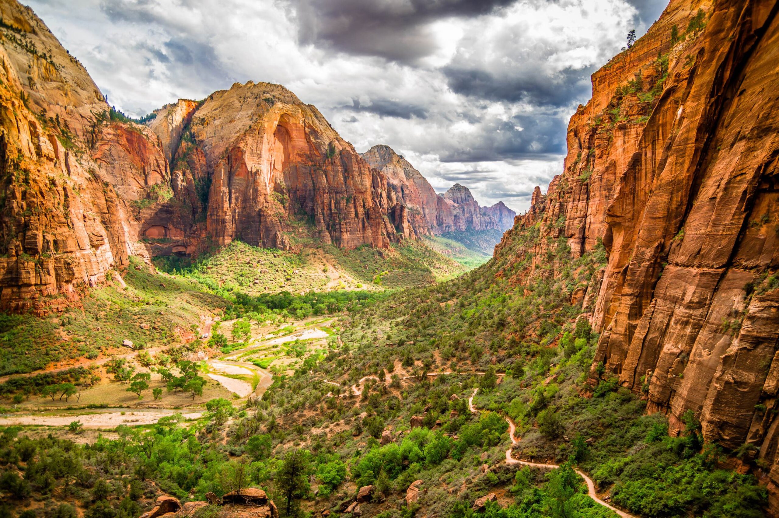
In southwestern Utah, immense red cliffs rise above the surrounding plateau. Sheer sandstone walls, the Virgin River below, and sunlight spilling into the canyon make Zion National Park a place of constantly changing perspectives. Each bend in the road and turn in the trail reveals another face of the landscape.
A Canyon Shaped by Time
About 200 million years ago, vast sand dunes covered this region. Over time, the sand hardened into Navajo Sandstone. Uplift of the Colorado Plateau and erosion by the Virgin River helped create the deep canyon we see today. Across Zion’s rock formations, layers and patterns preserve traces of ancient deserts, rivers, and seas.
A Land with a Long Human History
People lived in this landscape long before it became a national park. Ancestral Puebloan and Fremont cultural sites remain, and Southern Paiute people have enduring connections to the region. Nineteenth-century settlers used the name Zion, meaning a place of sanctuary. The area received national monument protection in 1909 and became a national park in 1919.
Zion Canyon — The Heart of the Park
The main canyon follows the Virgin River and brings together many of Zion’s best-known trails and viewpoints. The shuttle connects stops with very different scenery. On a first visit, one practical approach is to ride farther into the canyon, then stop at places that interest you on the return trip. With riverside walks and high overlooks to choose from, you can shape the day around your interests and energy.
Angels Landing
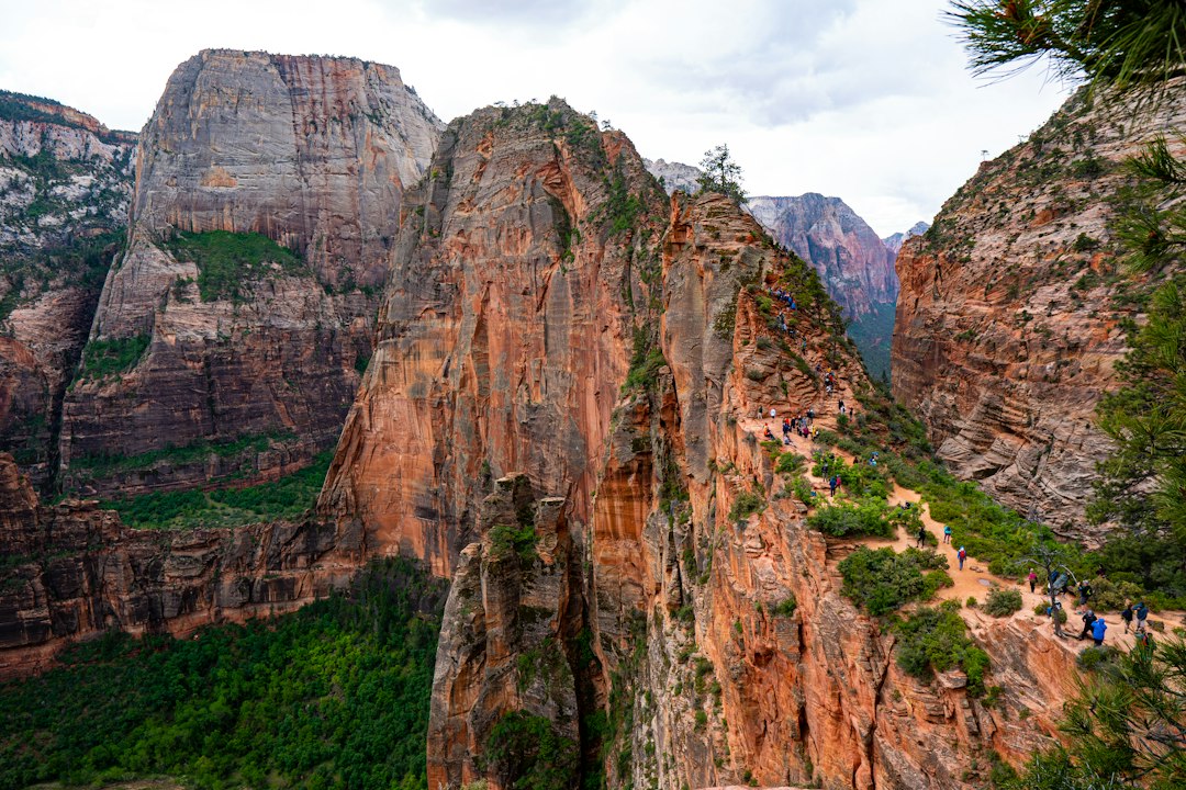
Approximately 5.4 miles (8.7 km) round trip; very strenuous. Steep climbs and a narrow ridge lead to sweeping views over the canyon. The exposed route is unsuitable for anyone uncomfortable with heights or steep drop-offs. A permit is required for the section beyond Scout Lookout toward Angels Landing. From The Grotto, follow the West Rim Trail to Scout Lookout; this viewpoint offers canyon views without an Angels Landing permit.
As the trail climbs, the river and road shrink below while the massive canyon walls draw closer to eye level. Much of the experience lies in watching the landscape change along the way. The chains do not eliminate the risk of a fall. Carry enough water, allow plenty of time, and avoid the exposed ridge in strong wind or rain.
The Narrows — Hiking Through the River
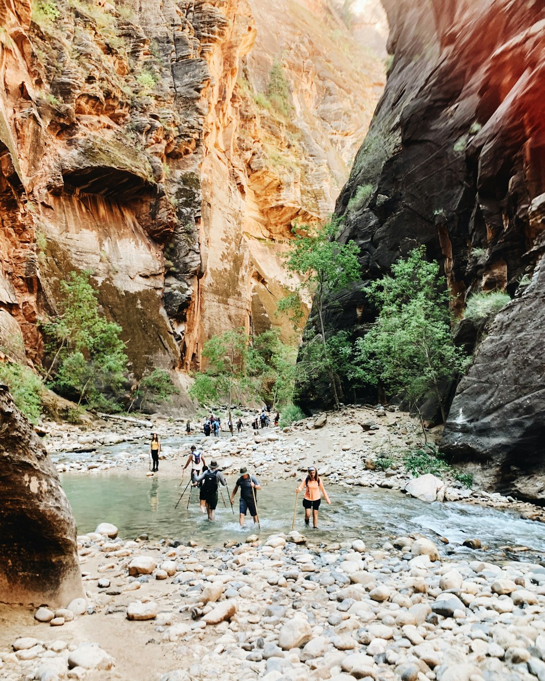
The Narrows is one of Zion’s most distinctive hikes: the Virgin River itself becomes the trail. You walk through water between towering sandstone walls, with depth and current changing from day to day. Light filtering into the narrow canyon, the sound of the river, and reflections on the rock create an experience unlike a conventional mountain trail. Most visitors begin at the Temple of Sinawava, follow Riverside Walk, then enter the river and turn around when ready. The permitted bottom-up day-hiking route does not require a Wilderness permit; the longer top-down trip does.
Uneven, slippery stones make progress much slower than on dry ground. Set a turnaround time before starting, leaving enough energy for the return. Rain upstream can cause a sudden flash flood even when the sky above you is clear. Check weather, river conditions, closures, and flood warnings before entering. Do not drink the river water, and check the park’s current toxic cyanobacteria guidance.
Riverside Walk
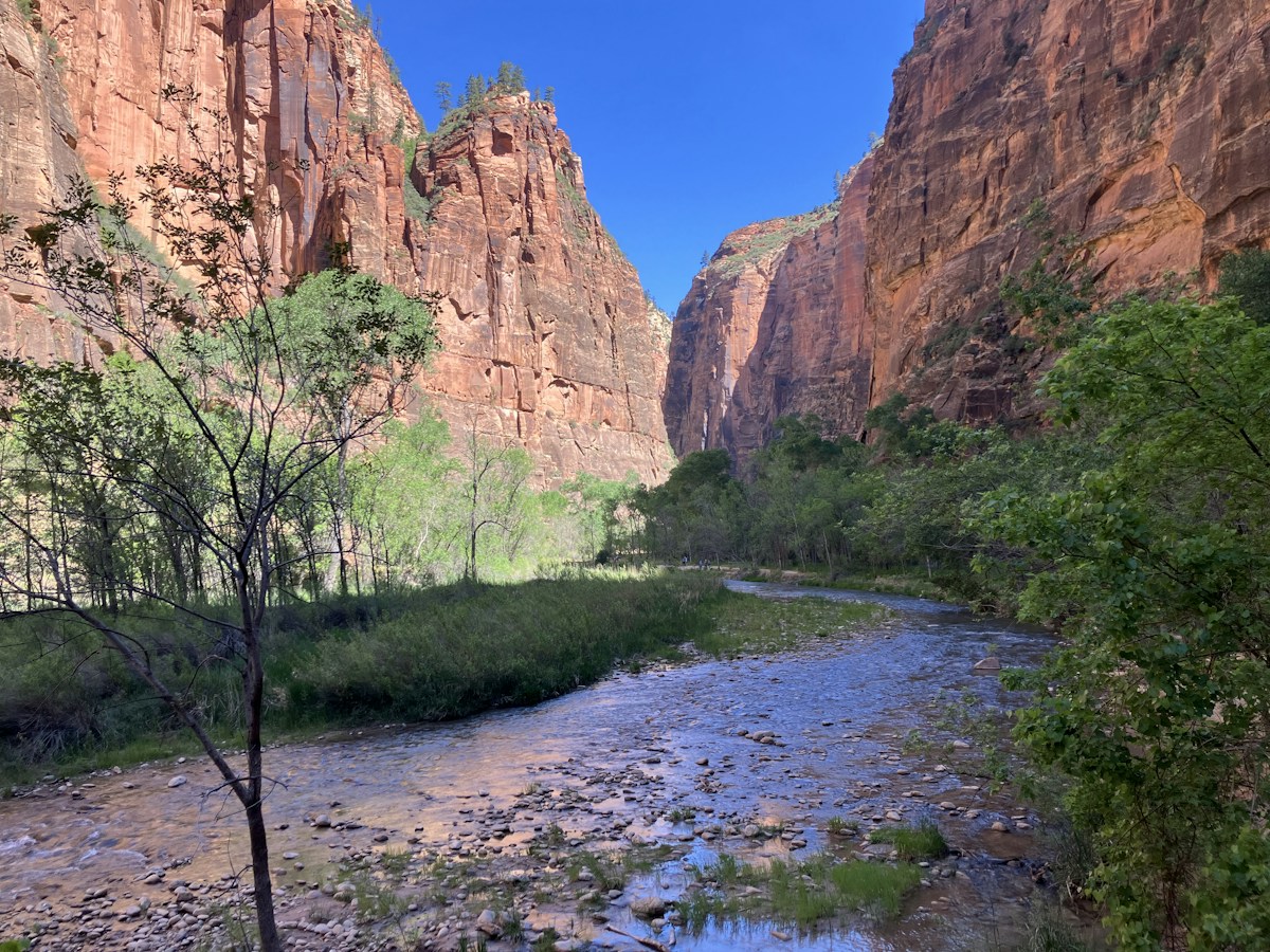
Approximately 2.2 miles (3.5 km) round trip; easy. This paved riverside trail leads to the entrance of The Narrows. Starting at the Temple of Sinawava, it follows the sound of flowing water as the canyon walls draw closer together. At the end, the paved path gives way to the river route. You can turn back without entering the water and still enjoy the atmosphere of the narrowing canyon. It is a good choice for a relaxed visit or a day when a longer hike feels like too much.
Emerald Pools
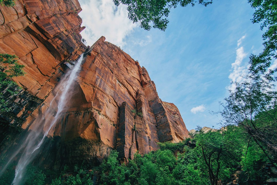
Approximately 1.2–3 miles (1.9–4.8 km), depending on the route; easy to moderate. Pools and seasonal waterfalls form an oasis beneath the sandstone cliffs. Water levels vary with the season and recent rainfall, and the time and climbing involved depend on which of the Lower, Middle, or Upper Pools you visit. Dripping water and plants beneath the rock overhangs contrast with the dry surroundings. Even when the falls are small or dry, the walk offers lovely views of the cliffs. Stay out of the pools, keep away from edges, and check which trails and access points are open.
Court of the Patriarchs
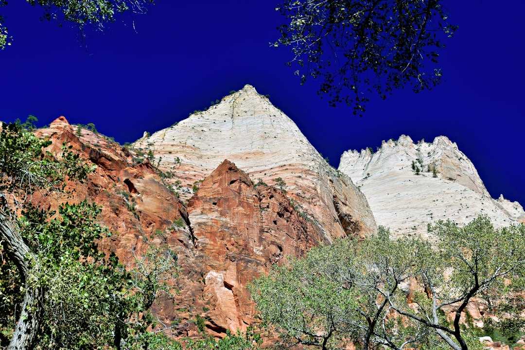
A short walk leads to a viewpoint facing three imposing sandstone peaks named Abraham, Isaac, and Jacob. It is an easy stop to fit between longer hikes. From a distance, the peaks may blend into one red wall, but a pause reveals their separate outlines and the shadows between them. As the light shifts, their colors and apparent depth change, giving the same view a different character throughout the day.
Weeping Rock
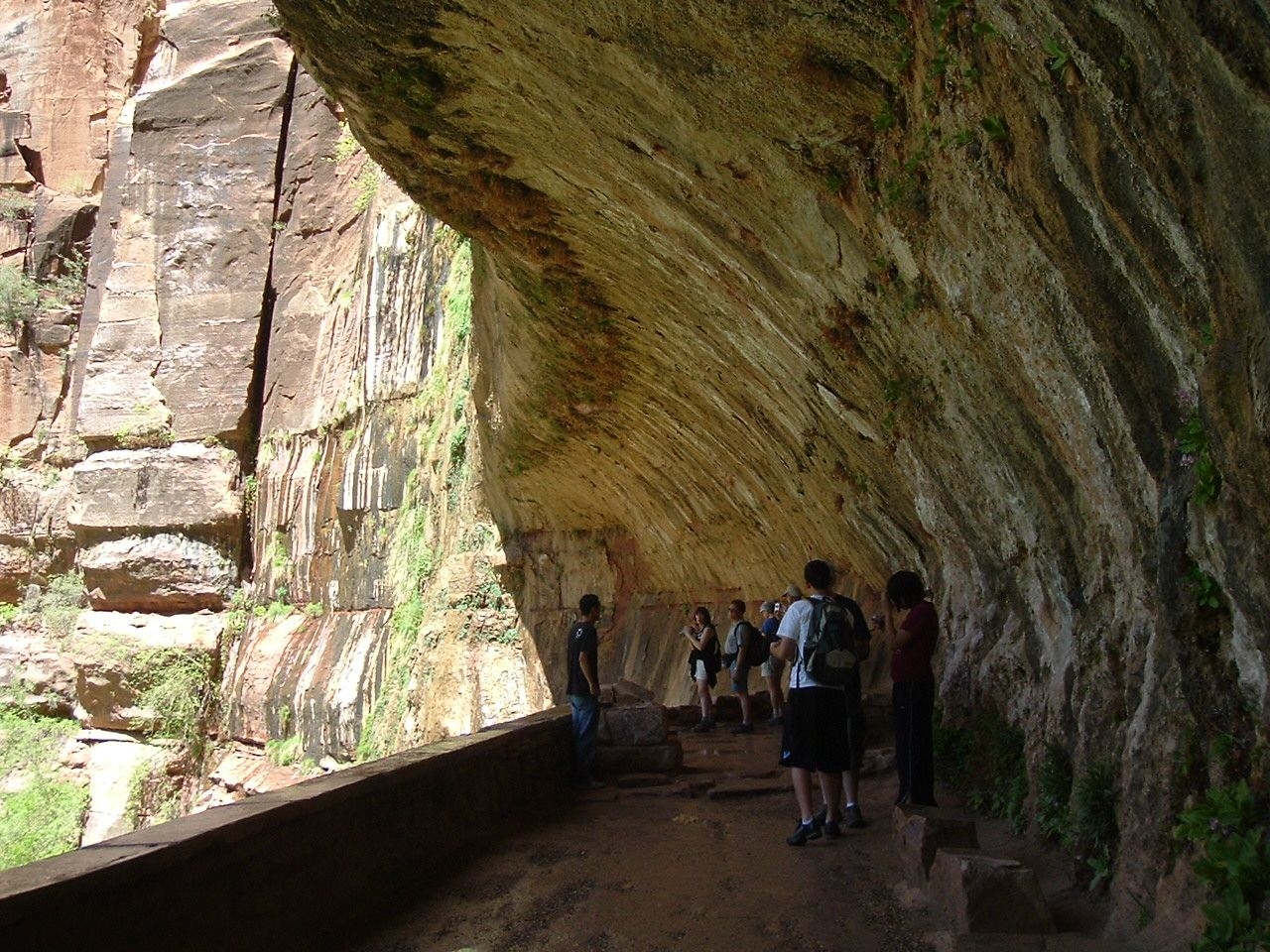
Water seeping from the sandstone moistens the rock overhang and supports small plants in an otherwise dry canyon. As water moves through porous sandstone and meets a less permeable layer, it emerges along the cliff face. Rockfall has caused long-term closures in this area and on connecting trails. Check the park’s current conditions before planning a visit rather than relying on photographs or older trip reports.
Big Bend
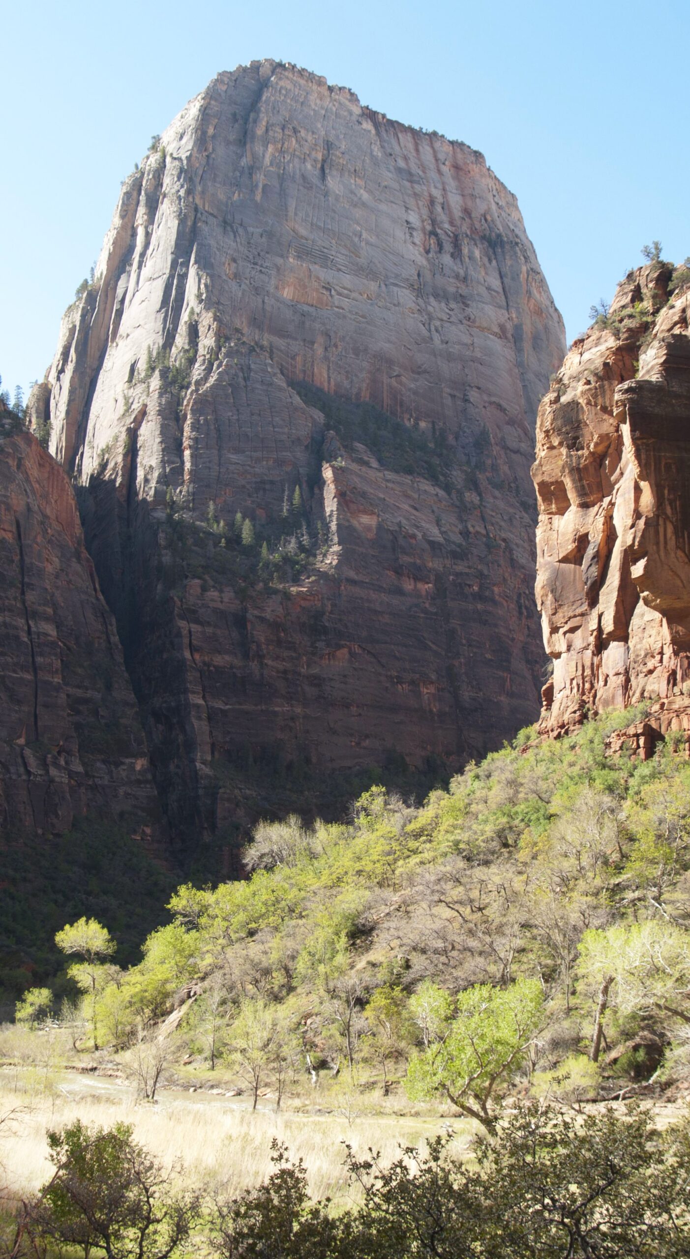
Big Bend offers a view of the Virgin River’s broad curve and the immense cliffs without a long hike. The bend in the canyon lets you appreciate both the height of the walls and the shape of the river. Looking up at a formation such as the Great White Throne, pictured here, creates a different sense of scale from looking down from a high overlook. It is a good place to pause between hikes or on a day with less walking. Follow local guidance for riverside access.
East Zion — Another Face of Sandstone
Heading east, the sheer canyon walls give way to rounded formations of white and red sandstone. The winding mountain road and historic tunnel become part of the journey, revealing a softer, more sculpted side of Zion.
Canyon Overlook Trail
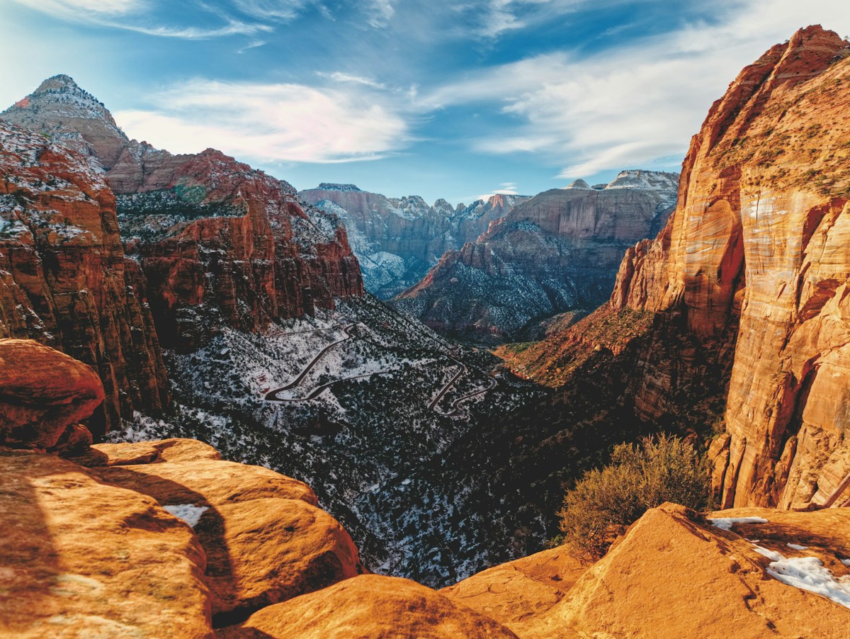
Approximately 1 mile (1.6 km) round trip; moderate. A short trail of rock steps and uneven ground leads to a viewpoint over Pine Creek Canyon. Beginning near the tunnel’s east entrance, the route gradually opens onto a panorama of winding road and towering sandstone walls. The perspective is very different from the view through a car window. Although short, the trail has uneven and exposed sections. Parking is limited, so allow extra time.
Checkerboard Mesa
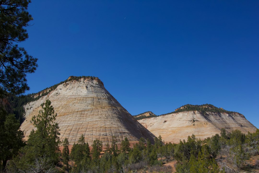
This pale sandstone formation is marked by intersecting lines that resemble a checkerboard. Ancient dune layers, cracks, and weathering have all helped shape its surface. After the deep red walls of Zion Canyon, the rounded eastern formations feel like a different landscape. Look first at the overall shape, then at the slanted layers and vertical cracks, which cross like threads in woven fabric. Use designated, safe parking areas when stopping to admire the view.
Zion–Mount Carmel Highway
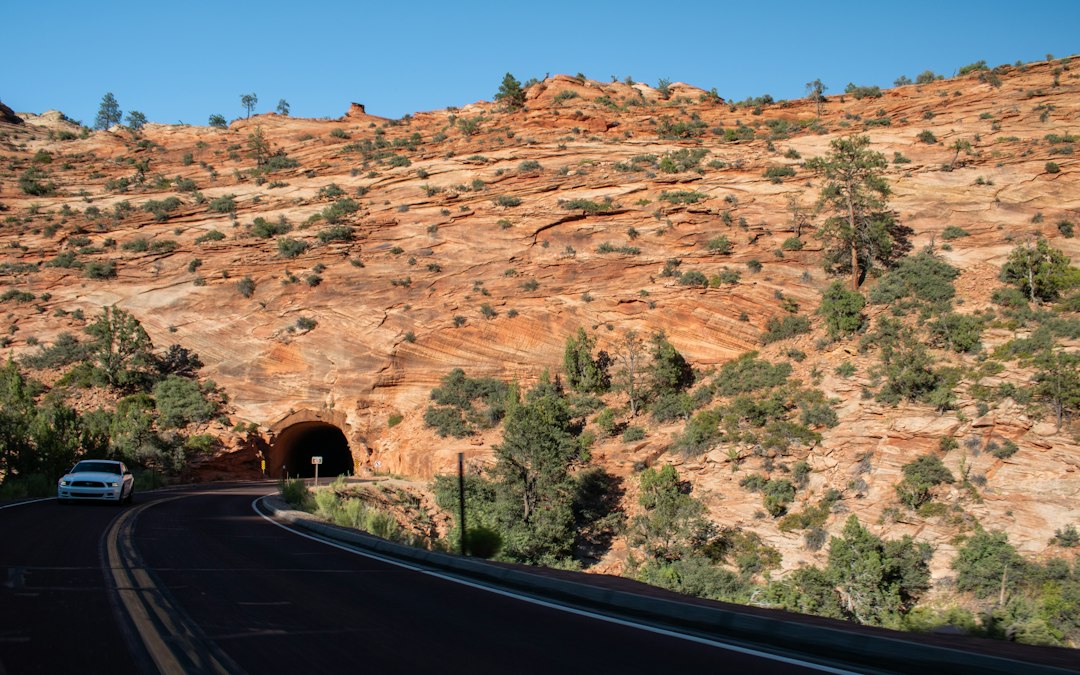
Along this winding road and its historic tunnel, the sandstone changes in color and form. Driving from the deep canyon toward the eastern uplands reveals a continuous transition in the landscape. Each curve presents another rock face, making the drive an experience in its own right. Keep your attention on the road and stop only in appropriate parking areas to enjoy the scenery. RVs and other large vehicles are subject to road and tunnel restrictions; check the current rules against your vehicle’s dimensions before traveling.
Observation Point
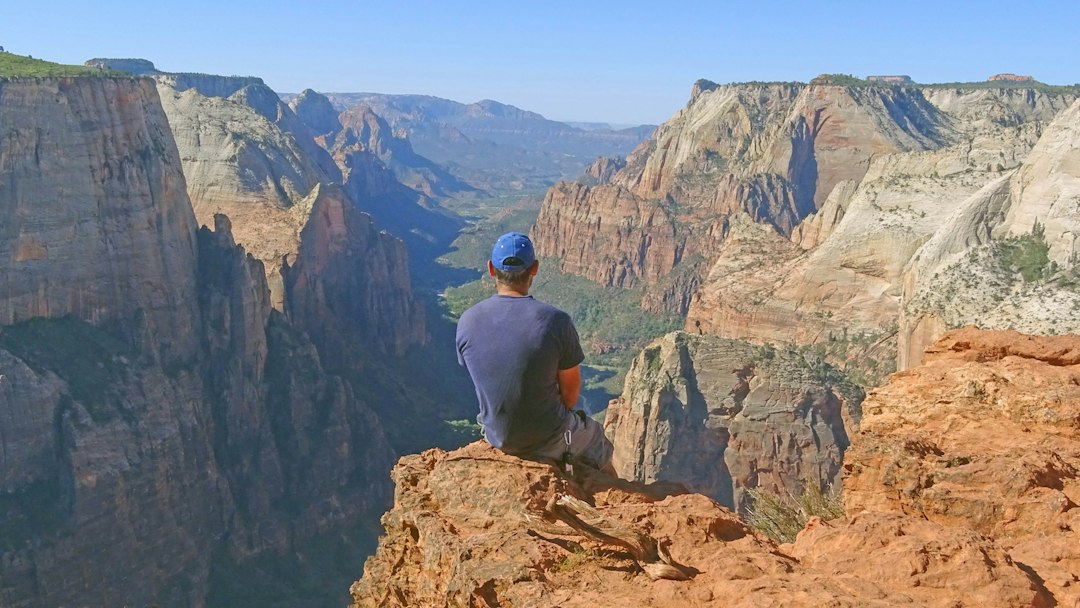
Approximately 7 miles (11.3 km) round trip via East Mesa; moderate. From this high viewpoint, Angels Landing and the bends of Zion Canyon fit into one expansive scene. It offers a different way to experience the canyon’s scale without the narrow chain-assisted ridge of Angels Landing. The old approach from Weeping Rock is closed, so plan around a currently accessible eastern trailhead. Weather can affect the unpaved access road to East Mesa; confirm road and trail conditions before setting out.
Kolob Canyons — The Quieter Northwest
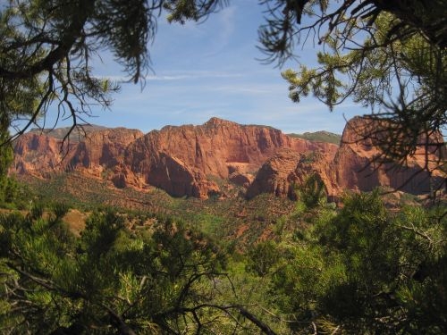
In Zion’s northwestern district, red sandstone cliffs, branching canyons, and woodland create a quieter setting with a character of its own. Kolob Canyons is a separate drive, rather than another stop on the Zion Canyon shuttle. Combine the scenic road with overlooks and short walks to enjoy a different rhythm from the main canyon. For a short first visit, concentrate on Zion Canyon; with more time, set aside at least part of a day for this northwestern landscape.
Timber Creek Overlook Trail
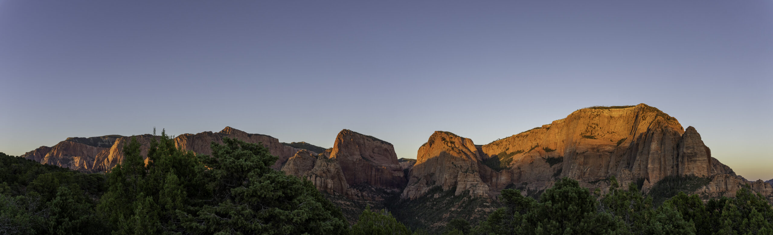
Approximately 1.1 miles (1.8 km) round trip. This relatively short ridge walk opens onto broad views of Kolob Canyons. Starting at the end of the scenic drive, it offers a striking contrast of pine trees and red peaks. The wide outlook makes it a rewarding way to experience the district without a long hike. Open sections can be windy, so bring a light layer and pay attention to changing weather.
Kolob Arch
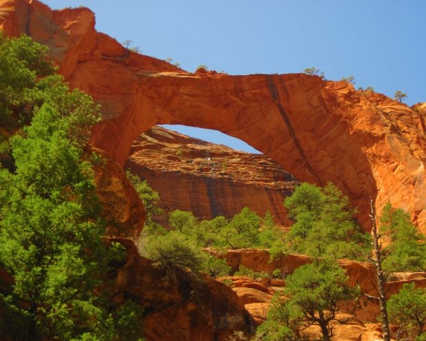
One of the world’s longest natural arches, Kolob Arch requires a substantial hike along the La Verkin Creek Trail: approximately 14 miles (22.5 km) round trip. Photographs can make it seem close, but reaching it means a long walk into the backcountry. For a day hike, start early, carry ample water and food, and work backward from a realistic return time. Give this outing a day of its own. For a shorter introduction to Kolob Canyons, Timber Creek Overlook is a more practical choice.
Zion Through the Seasons
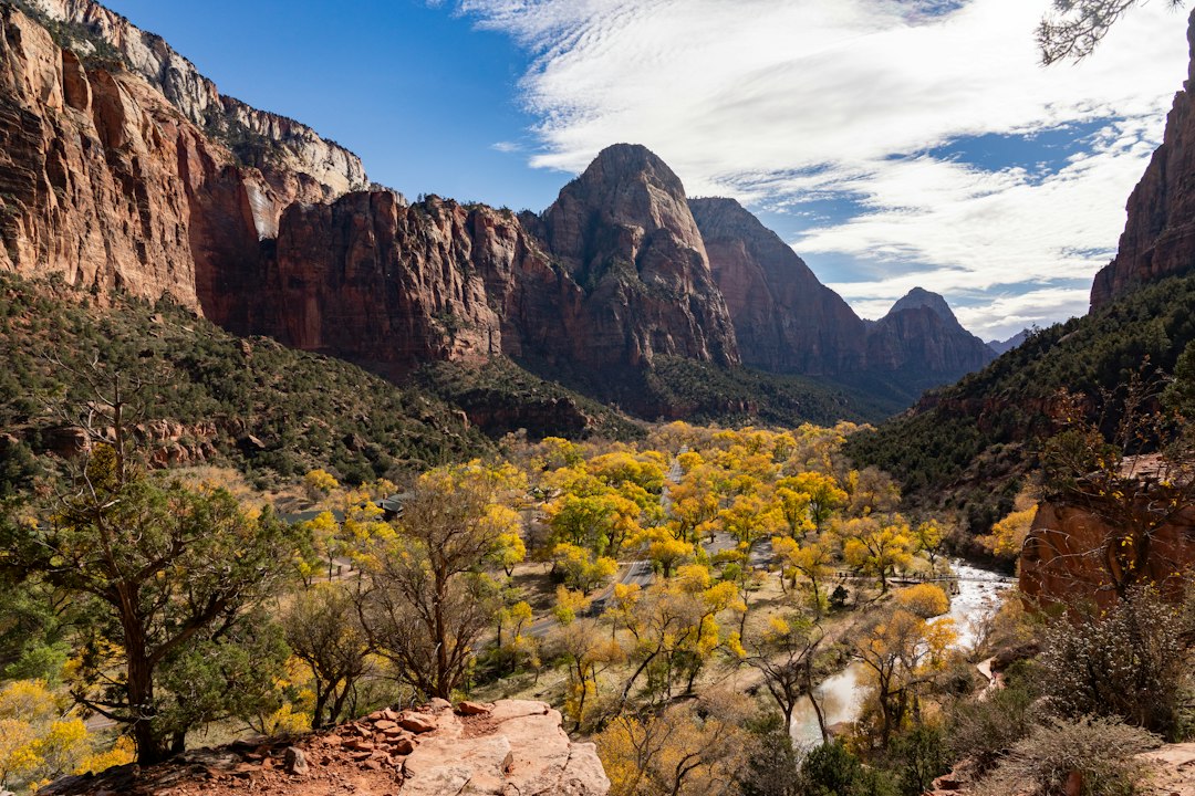
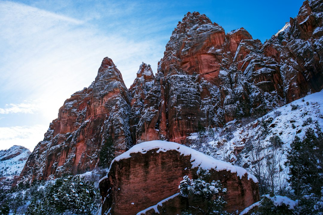
Spring brings wildflowers and fresh greenery; summer sets lush vegetation against red rock. In autumn, riverside trees turn gold, while winter snow gives the cliffs a quieter appearance. Each season changes how you should prepare. Spring snowmelt can raise river flows and close The Narrows. In summer, hike early and rest during the hottest part of the day. Autumn can bring large temperature swings, and ice may linger on shaded rock steps in winter. Plan for the actual weather and trail conditions, not just the season shown in a photograph.
Planning Your Visit
The drive from Las Vegas usually takes about 2½–3 hours. Two or three days allow a good introduction; three or four give you more room for several hikes. Springdale is a convenient base, and Utah is one hour ahead of Las Vegas. Private vehicle access to the Zion Canyon Scenic Drive is restricted during shuttle operations. Check the National Park Service for current closures, permits, shuttle schedules, and weather. With one day, combine the canyon shuttle, Riverside Walk, and shorter viewpoints. On a second day, focus on one longer outing such as Angels Landing or The Narrows, adding East Zion or Kolob Canyons if time allows.
Leave room in the schedule for parking, shuttle queues, photographs, and breaks. A day can fill much faster than the distances on a map suggest. Check the last shuttle before beginning a hike, and download maps and any required permit confirmation in advance because cell service can be unreliable. Water, snacks, sun protection, and footwear with good traction make both short walks and longer hikes more comfortable.
More Than a Single Day’s Scenery
A canyon where the river becomes a trail, ridges that seem to touch the sky, patterns left by ancient dunes, and a landscape shaped by generations of human history: Zion changes with every route you take. The fact that one visit cannot reveal it all is part of what makes you want to return.
Visitor information: Zion National Park — Official Planning Guide